Cold-season gears are already turning as a sharp stratospheric warming loosens the polar vortex. High above the surface, temperatures are spiking fast, so the jet stream can buckle and storm tracks wander. That setup often tilts mid-latitudes toward early winter, while details still hinge on where the vortex finally settles. This timing is rare for November, and recovery usually takes weeks. Because the high atmosphere pulls hidden wires, small shifts can still sway outcomes. Model guidance already hints at a pattern flip.
What a weakened polar vortex can change in a hurry
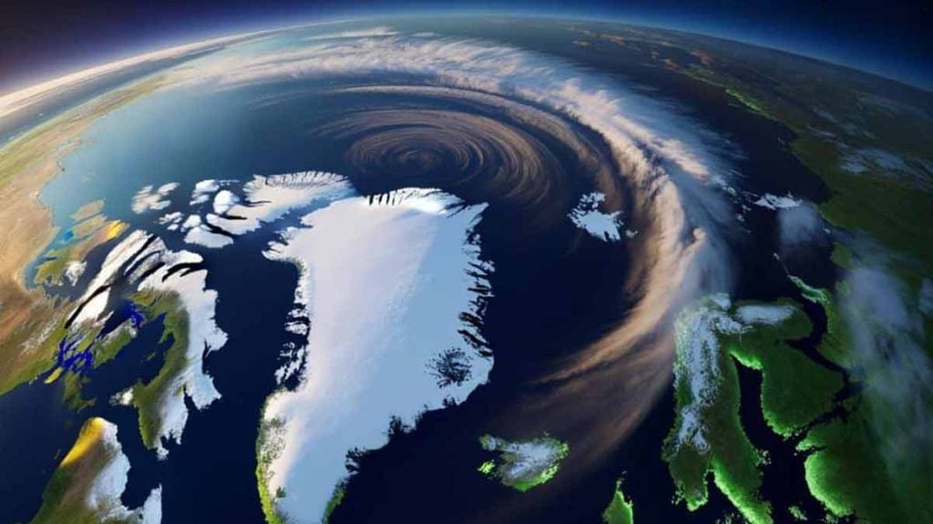
Temperatures in the dry stratosphere can jump by tens of degrees within days. Meteorologists call this a sudden stratospheric warming. The surge weakens the tight westerly winds encircling the pole. As that circulation slackens, cold pools escape their cage and the jet stream becomes easier to bend.
When the vortex slows, it can wobble, drift off the pole, or even split. Each shape matters because it tugs storm tracks onto new rails. A displacement toward Siberia favors European cold snaps. A ridge near Alaska often carves a downstream trough into central and eastern North America.
Because the polar vortex sits high above daily weather, cause and effect take time. The surface often responds one to three weeks later, as blocking builds and the jet dips. Confidence is higher on the pattern flip than on which city gets the longest cold or heaviest snow.
Why an early-season polar vortex disruption raises the stakes
Big stratospheric warmings usually peak after New Year, not in November. An event this strong so early sits near the edge of the satellite record. Because the atmosphere recovers slowly, a hit now can prime December for cold spells. Snow chances become more frequent, and storm intensity can swing sharper.
Early signals may show near Thanksgiving, while the fuller punch often lags by one to three weeks. That window raises odds for a negative Arctic Oscillation and, at times, a negative North Atlantic Oscillation. Those phases often align with blocking, a bent jet, and continent-spanning cold intrusions.
Nonetheless, small shifts aloft still matter because they steer the polar vortex wobble. Tropical forcing from the Pacific can also reshape the jet, so storms may outrun the cold. Ensemble guidance maps the range, yet the spread stays wide at this lead time for exact city-level outcomes.
What a blocked pattern means on the ground
Model guidance points to increased blocking within one to three weeks. A ridge near Alaska often pairs with a downstream dip over central North America. In Europe, a Greenland block can bend the jet south. That pattern allows fresh Arctic air to spill into Western and Central Europe more often.
Western Canada faces colder spells with early snow risks and icy roads. Central and eastern United States see higher chances for cold shots and snow systems if the jet dips south. Northern Europe risks repeated Arctic intrusions, while Southern Europe turns stormier, with mountain snow possible during stronger surges.
East Asia can see sharper cold outbreaks, especially if the polar vortex shifts toward Siberia. Energy demand typically jumps as heating use climbs, so power grids prepare for higher morning peaks. Air travel often feels ripple delays, because wind patterns change, turbulence reshapes routes, and snow events strain schedules.
Science, satellites, and the diagnostics forecasters watch
Stratospheric data underpins these calls, with polar-orbiting satellites measuring winds and temperatures far above flight levels. That stream feeds models that gauge the vortex’s health. Aging platforms and coverage gaps can complicate the view. Reanalyses and ground sensors help fill holes when key channels go missing. Data quality still matters.
Forecasters track a key diagnostic: the zonal wind at 60°N and 10 hPa. When that wind weakens sharply or flips easterly, the vortex is disrupted. Planetary waves, launched by major ranges and strong temperature contrasts below, often pump energy upward. They can kick-start the weakening sequence seen in models.
Expect model notes on wave-1 versus wave-2 forcing in the coming weeks. Strong wave-1 tends to displace the polar vortex, while strong wave-2 supports a split. Keep an eye on snow cover across Siberia and Canada, which helps feed colder air masses downstream. That background state favors colder snaps.
Real-world steps, travel planning, and market signals to watch
Because colder snaps arrive with little notice, tighten your home now to cut heat loss. Replace worn weatherstripping, seal outlets, and check attic insulation. Service furnaces and heat pumps, while you clean filters to improve reliability. Prep vehicles with winter tires, rated wiper fluid, and a simple emergency kit.
Review travel plans with flexible dates, because snow-related delays ripple fast. Communities can stage de-icing supplies and confirm snow route staffing before the first burst. Farmers and ranchers should ready shelter and water heaters for livestock. They should secure feed, check fencing, and mark access paths for plows.
Energy traders track these signals because heating demand can jump during a strong flip. A negative AO with a downstream jet dip lifts morning power peaks and natural gas burns. Public health planners watch as dry cold supports faster virus spread, while the polar vortex shift pushes more people indoors.
Why early signals now may shape your next few weeks
Signals are lining up for a faster turn toward winter, even while exact impacts remain location-specific. Because the stratospheric shift unfolds with a lag, controls you set today can blunt the first cold stab. Keep watch on 60°N winds, AO and NAO charts, and hemispheric ridges. If the polar vortex keeps weakening, odds rise for colder snaps and snowier tracks. Stay flexible on travel, tune heating systems, and shore up drafts before the background state locks in.